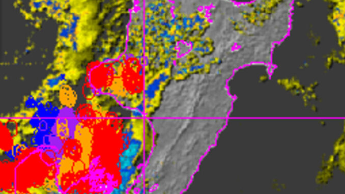
Lightning strikes are lighting up the skies in many areas, with storms and a swathe of yellow and orange weather warnings and watches across much of the motu.
By 7pm, NZTA was warning of surface flooding in Wellington, with drivers asked to take care on SH1 in the suburb of Mount Cook, and at the Basin Reserve.
MetService said its rain radar was pasted with storm signs, and evidence of lightning strikes was plastering the Transpower lightning strike recording data, across many parts of the lower North Island and top of the South Island.
The heaviest rain is expected in the South Island, while the thunderstorms were expected to move up the North Island during Saturday and into Sunday.
The full map, with key Photo: Supplied/ MetService
North Island
The angry weather will sweep up much of the North Island overnight from midnight Saturday through to 7am Sunday, MetService forecasters say. It could become severe or bring heavy downpours, flash floods and dangerous driving conditions, with wind gusts up to 110kmh or stronger.
“Some of these thunderstorms may generate localised downpours of 25 to 40 mm an hour, especially from Waitomo southwards,” a MetService spokesperson said.
“Wind gusts of this strength can cause some structural damage, including trees and power lines.”
- An orange thunderstorm watch has been placed over: Northland, Auckland, Waikato, Waitomo, Taumarunui, Taupō, Taranaki, Taihape, Wanganui, Manawatū, Tararua, Kāpiti-Horowhenua, Wairarapa and Wellington.
- The Tararua Ranges in particular are expected to get a drenching, with an orange heavy rain warning issued, for the period from 6pm Saturday to 6am Sunday.
- A strong wind watch has been added for Wellington and Kāpiti Coast.
A MetService data map representing lightning strikes recorded by Transpower, across a wide swathe of the country on Saturday evening, 31 August, 2024. Photo: Supplied/ MetService


